
Guides · Cycling in Taiwan
When to Ride Wuling Month by Month, and What 3,275 m Means Where You Come From
Around October offers the best overall conditions, and late March to early May and late September to November are also fairly stable. Avoid the plum rains of May and June, the typhoons of July to September and the freeze from December to February. At 3,275 m Wuling is the highest point on any road in Taiwan, and how that height feels depends on where you ride at home. The highest road in Hong Kong tops out around 930 m, and Japan's Norikura reaches 2,716 m. This guide sorts out the months first, then lines up the highest paved roads of several countries against Wuling, and ends with the notices to check before you leave. The month only gives odds, and the road on the day decides whether you ride.
Which Months Work for Wuling
Take out the plum rains, the typhoons and the freeze, and what remains is late March to early May and late September to November. The road is usually dry in both stretches, there is no ice risk and the weather is comparatively settled; autumn adds the chance of a sea of clouds and a good sunset. If you can only pick one, around October is usually best, since the typhoon season has wound down and the winter freeze has not started. Korean riders also generally treat the time around Mid-Autumn as the right window. The table below goes month by month. These are probabilities, so check the notices before you leave and the road on the day.
| Months | Verdict | Why |
|---|---|---|
| December to February | Avoid | The freeze. Snow is most likely from late December to early February. When the road ices over, Highway 14A is closed pre-emptively from the 18 km marker at Cuifeng to the 41.5 km marker at Dayuling, or restricted to vehicles with snow chains. A bicycle cannot fit chains, so riding is not possible while it lasts |
| Late March to early May | Go | The road is usually dry, there is no ice risk, and the weather is comparatively settled |
| May to June | Avoid | Plum rains: high chance of rain and thick mountain fog, and poor visibility makes the descent especially risky. During the rhododendron season the 29 km Kunyang to 33.2 km Shimen Shan section runs high-occupancy and flow control from 06:00 to 11:00 on weekends and holidays |
| July to September | Avoid | Typhoon season. The outer circulation alone brings winds and rain heavy enough to close mountain roads for days, and even without a typhoon, afternoon thunderstorms are frequent |
| Late September to November | Go | Settled autumn weather with a good chance of a sea of clouds and a strong sunset. Around October sits between the end of the typhoon season and the start of the freeze, the best overall window of the year |
Highest paved roads in other countries compared with Wuling
Hong Kong's highest peak, Tai Mo Shan, stands at 957 m, but cyclists cannot reach the top. Everything above 930 m is a restricted zone and the road ends at the gate around 930 m. Korea's highest paved pass, Manhangjae, is 1,330 m. Vietnam's highest paved pass, Ô Quy Hồ, is about 2,035 m (sources range from 2,035 to 2,073 m). Thailand's highest point, Doi Inthanon, is 2,565 m and paved the whole way. Japan's highest paved road point, Norikura, is 2,716 m. The highest paved pass in the Alps, the Col de l'Iseran, is 2,764 m.
Apart from Spain's Pico Veleta, Wuling is higher than every one of them. For a Hong Kong rider it is more than three times the height of home, for a Korean rider two and a half times Manhangjae, and a Japanese rider who has already climbed Norikura still has roughly 559 m more to go. The climbing experience you built at home may not cover anything above 3,000 m. Altitude sickness and hypothermia are rarely a problem on the mountains you know, and here they can happen.
Plum rains, typhoons and the freeze
May and June are the plum rain season, with a high chance of rain and thick mountain fog, and poor visibility makes the descent especially dangerous. This is also the Hehuanshan rhododendron season. On weekends and holidays, traffic and crowds are both at their peak. Many Wuling events are traditionally held in these two months because a race has traffic control and support stations. An independently planned trip has no reason to join the crush.
July to September is typhoon season. A typhoon does not have to make a direct hit, since the strong winds and heavy rain of an outer circulation can close mountain roads, sometimes for several days. Even without a typhoon, afternoon thunderstorms in the mountains are frequent, so every afternoon carries some uncertainty. December to February is the freeze, and snow is most likely from late December to early February. When the road ices, the highway authority may close the road preemptively, or open it only to vehicles fitted with snow chains. A bicycle cannot fit snow chains, so nobody rides while the closure lasts.
Mountain temperatures and layers
Mountain temperatures run roughly 15 to 18°C below the lowlands. In summer the summit sits around 12 to 18°C by day and often drops below 10°C after dark. From December to February daytime averages are around 5°C or lower, with nights frequently below zero. Even in September or October it may still be 30°C on the plains at the start while the summit is in the teens. You sweat on the climb, wait at the top, then face the wind chill of a long descent, so bring windproof and insulating layers. A rider who packs only for the climb will be cold on the way down.
Checks before you leave and on the day
The months are probabilities. October can still catch a late typhoon, March can still catch a cold front that ices the summit, and control notices are revised against the forecast. Before you leave, confirm the current notices from the highway authority and the Taroko National Park Headquarters covering Highway 14A and the eastern Central Cross-Island section. The night before and again at dawn, check the live cameras at Kunyang, the Hehuanshan visitor centre and Wuling Pavilion. A live camera shows directly whether the road is dry, wet or snow-covered right now.
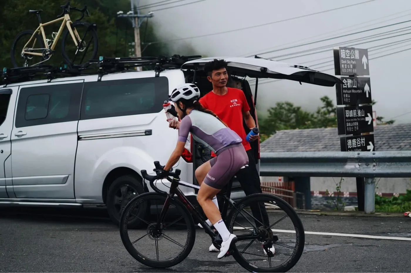
Leave one spare day in a Wuling trip, so a closure or heavy fog can push the ride back. The support vehicle gives you a safe way out when the weather turns. If it is too cold at the top you do not have to force a descent by bike, if conditions deteriorate you can pull out partway, and supplies, warm layers and a spare wheelset do not all have to be carried up 3,000 metres on your back. If your schedule allows only one day and you have flown in from abroad, budget for the support vehicle from the start.
Highway 14A right now
The notices and camera images below are fetched from the highway authority when you open this page, with notices lagging by ten minutes at most. Monthly statistics only give you odds. Checking here the night before and again at dawn tells you far more.
Live notices from the highway authority
台14甲線雙向31K+500武嶺路段,周邊停車場已滿,建議用路人斟酌前往及請勿違停路邊。
台14甲線雙向31K+500武嶺路段,周邊停車場已滿,建議用路人斟酌前往,以及請勿違停路邊以避免影響通行安全,警察將持續加強取締違規,並請注意路況小心駕駛。
台14甲線雙向0K至0K+061霧社路段,於全車道進行路面刨鋪作業。
台14甲線雙向0K至0K+061霧社路段,自115年11月4日至115年11月6日每日9時至16時止,於全車道進行路面刨鋪作業,依現況單線機動管制,請注意路況並小心駕駛。
台14甲線雙向2K+500至3K+500仁愛國中路段,於全車道進行路面刨鋪施工。
台14甲線雙向2K+500至3K+500仁愛國中路段,自115年10月12日至115年11月2日每日19時起至隔日6時止,於全車道進行路面刨鋪施工,現場交管維持單線雙向機動管制通行,例假日不施工,請注意路況並小心駕駛。
台8線114K+600~167K+300(合歡派出所至天祥)沿線災修工區施工管制
6時30分至16時30分開放通行;18時30分至翌日6時30分夜間封閉(含假日)
台14甲線東向0K至31K+500霧社至武嶺路段,進行2026FormosaXtremeTriathlon極限鐵人三項賽。
台14甲線東向0K至31K+500霧社至武嶺路段,自115年11月13日當日6時起至24時止,進行2026FormosaXtremeTriathlon極限鐵人三項賽,用路人行經活動路段,請注意主辦單位設置告示牌面及交管人員指揮小心通行,或提前改道行駛。
台14甲線合歡山地區18K至41K翠峰至大禹嶺路段,凡3日以上連續假日將實施高乘載管制,,並由現場警察機關視交通狀況機動調整,管制路段西端管制點設於18K翠峰管制站,東端管制點設於41K大禹嶺管制站,請遵循現場管制人員導引注意小心駕駛。
台14甲線合歡山地區18K至41K翠峰至大禹嶺路段,自115年10月24日光復節連續假期開始,凡3日以上連續假日將實施高乘載管制,管制時間為連假期間每日凌晨 0 時至上午 8 時,並由現場警察機關視交通狀況機動調整,管制路段西端管制點設於18K翠峰管制站,東端管制點設於41K大禹嶺管制站。限搭乘3人以上小客車通行,客運接駁車及乙類大客車不受限制,機車與慢車不管制,管制期間禁止大貨車進入,請遵循現場管制人員導引注意小心駕駛。
Live cameras
FAQ
How does Wuling compare with the highest road back home?
Wuling is 3,275 m. That is about 2,345 m above the top of Hong Kong's Tai Mo Shan road (around 930 m), about 1,945 m above Korea's Manhangjae (1,330 m), about 1,240 m above Vietnam's Ô Quy Hồ (about 2,035 m), about 710 m above Thailand's Doi Inthanon (2,565 m), about 559 m above Japan's Norikura (2,716 m), and higher than the Alps' highest paved pass, the Col de l'Iseran (2,764 m). If all your climbing experience is below 2,000 m, this will be the first time you put out power above 3,000 m.
Which month of the year is best?
Around October. Late March to early May and late September to November are both relatively stable, and October sits between the end of typhoon season and the start of the freeze. Avoid the plum rains and rhododendron-season crowds in May and June, the typhoons and afternoon thunderstorms from July to September, and the freeze from December to February. These are probabilities, so check the notices before departure and the road on the day.
Can I ride when the road is iced?
No. When the road ices, the highway authority may impose a preemptive closure on the Cuifeng-Dayuling section of Highway 14A, or limit access to vehicles fitted with snow chains. And a bicycle cannot fit them. Even on a day with no formal closure, ice on the shaded side is not always visible, and on a descent, with high speed and a very small contact patch, the consequences of going down are nothing like they are in a car. If you want to see snow, go up by vehicle and move the ride itself to a day when the surface is dry.
What should I wear for a summer ascent?
Mountain temperatures run roughly 15 to 18°C below the lowlands. In summer the summit is around 12 to 18°C by day and often below 10°C after dark. Thirty degrees at the start says little about whether the top will be comfortable. You sweat on the climb, stop at the top for photos, then drop at speed for over an hour, and wind chill puts the felt temperature far below the actual reading. At minimum, bring a windproof jacket and a packable insulating layer; gloves and warm accessories for a long descent are worth having too. None of this has to be carried up on your back. It can travel in the support vehicle and be put on at the top.
Sources
- 交通部中央氣象署(合歡山測站觀測資料)
- 交通部公路局(雪季封閉公告)
- 交通部公路局(杜鵑花季高乘載管制)
- 太魯閣國家公園管理處(公路即時路況)
- 乗鞍エコーライン(国土交通省 多言語解説)
- List of highest paved roads in Europe by country (Wikipedia)
Rules and road conditions change, so always check the official announcements before you travel.
Related guides
- Wuling Hehuanshan Cycling|Taiwan's Highest Road, 3,275m
- What to Eat After Wuling? Qingjing Urn-Roasted Chicken
- Riding Between Company Branches, and How the Support Vehicle Is Arranged
Elsewhere in the ecosystem
- power · AI Trainingreads power meter files and writes the day's training prescription
Need a support vehicle?
Tell us your plan and we will suggest an option based on group size, bike count, and days.